Integrated wayfinding system for Cubbon park
- Nov 23, 2019
- 1 min read
Updated: Mar 19, 2020
A bi-lingual signage system that eases navigation & captures the history, culture & biodiversity of Bengaluru’s 197 acre public park
Client: Department of Tourism (Karnataka), Horticulture Department
Location: Cubbon Park, Bengaluru
Partner/Collaborators: Horticulture department, Native place
Duration: October 2017 - May 2019
Status: Completed

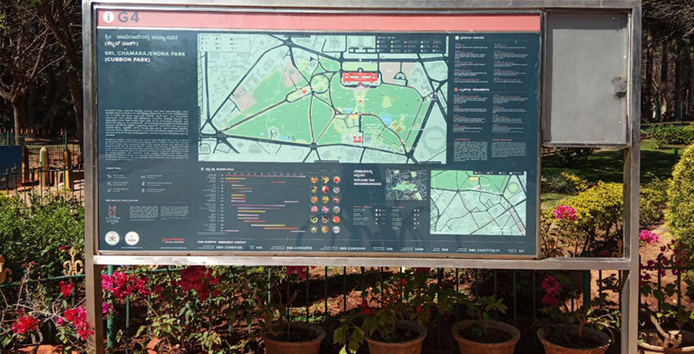
This 140 year old public park, second largest in Bengaluru is one of the city’s most vibrant landmarks and widely used public spaces. Used by people from all stratas of society, this park is a tourist attraction flanged on all sides with the highest density of art, historical and cultural destinations in the city.
The objective of the project was to create an integrated way-finding system to make it easily navigable and provide information to connect the park to the cultural assets all around.
Keeping in mind the diverse users of the park the signage system uses maps, symbols and images as a way of communication and also has information that is written in both Kannada and English. There is also a provision made for a braille map in the future. The system includes 76 pieces and 6 types of signages that cover the entire park. This includes - gateway, inner gateway, destination, directional, markers (5km track) and pocket libraries.
An integral part of the signage, was the 35 layered map of the park, which was developed through a 3-participatory process that involved different stakeholders especially the users of the park. To know more about this process click here..


News and Media:


Comments